


Biking
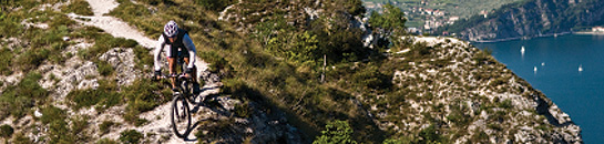
Lake Tahoe offers some of the finest bicycling in the west. From easy paths along the lake shore to tackling advanced singletrack, the scenery and trails make bikes essential equipment for many Lake Tahoe visitors.
This Lake Tahoe Bike Trail Map is a handy reference, and there are many bike shops in the area for rentals, tune-ups and suggestions.
Mountain Biking
Lake Tahoe is filled with singletrack and fire road options, from short, strenuous rides, to all day excursions.
Lake Tahoe’s mountain biking season usually runs from July through November. Bicycle paths are open between Memorial Day and Labor Day weekend. Beyond that you’re riding at your own risk, as the trails are not maintained during winter months.
Trails
If you're just starting your mountain bike career and want to get in some easy singletrack, head to Truckee and try the Emigrant Trail ride. About 20 miles out and back, it offers rolling hills on a single dirt trail and is categorized novice-to-intermediate. From the same starting point are a couple of 17 mile intermediate and advanced rides.
No list of great Sierra cycling can be without the Flume Trail, which is considered one of the most scenic bike rides in the nation. Classified for intermediates, it's not a ride for beginners. The trail starts out at Spooner Summit State Park on the east shore and, even though it's a wide trail, it's a steady climb for 3.8 miles before shooting a fun downhill to Marlette Lake. If you haven't ridden at altitude, the climb could be a scorcher on your lungs.
The Tahoe Rim Trail is a 165-mile loop, and is home to some of the greatest views in the United States. More than 80 miles are open to mountain bikes. Read directional signs posted at the trailhead to see where you may and may not ride.
Mr. Toad's Wild Ride is a strenuous and technical ride dropping from 9,000 feet to 6,800 feet in three miles. To access the trail, take the Tahoe Rim Trail from the Big Meadows parking lot 2.5 miles to Tucker Flat. Turn left and follow the drainage of Saxon Creek. The trail forks again in two miles. The right fork leads to Oneidas Street off of Pioneer Trail, while the left fork leads to Highway 89, south of the Highway 89/50 junction.
Tahoe Trailways (West Shore) Bike Path: Tahoe City serves as the hub of the Trailways Bike Path system and offers access to numerous West Shore activities. Fifteen miles of paved pathways extend from Tahoe City in three directions. Funded by Cal Trans and maintained by the Tahoe City Public Utility District (TCPUD), this popular system of trails connects Sugar Pine Point State Park on the south, Alpine Meadows on the northwest and Dollar Point on the northeast. Campgrounds, picnic areas, beaches, restaurants, the Gatekeeper's Cabin Museum, and the communities of Homewood, Tahoe Pines, Sky land, Timberland, Pineland, and Sunnyside are found along the way.
Incline Village/Lakeshore Drive Bike Path (Northeast Shore): Known locally in Incline Village as "The Joggers Trail", this 2.5 mile long paved trail starts at Gateway Park on Highway 28. Maintained by Washoe County, this path passes close to the shore of Lake Tahoe's Crystal Bay and many interesting attractions.
The Paved Truckee River Trail, starting at the edge of Tahoe City closest to Squaw Valley, is a four-and-a-half-mile, two-way trail popular with runners and people walking with children and dogs, so don't expect to hit top speed. The views of the Truckee River are first-rate. A good novice ride.
Road Biking
If knobby tires aren’t your thing, hop on the road bike and check these routes out.
Circle Lake Tahoe. Let’s start big. It’s 72 miles, very scenic and flat for the most part, except for a good climb to the summit of Dollar Hill. A challenging ride, but you can say you rode all the way around Lake Tahoe. Because you know you want to say that.
Lakeshore Drive. Leisurely 2.5 miles along the lake, known as the Jogger’s Trail.
Tahoe City to Sugar Pine Point State Park is 9 miles total one way, with 7 miles on a bikepath and 2 highway shoulder. Lake views along the way and the park has picnic areas, beaches, playgrounds, swimming.
Tahoe City to Dollar Point is 2.5 miles one way, all bikepath, with detours to beach, fishing, boating, playgrounds at Lake Forest. Slight uphill climb.
Tahoe City to Squaw Valley is 8 miles, mostly bikepath with 1/2 mile of highway shoulder riding just before the access road. Ends at the Village at Squaw Valley, with shopping, dining, recreation.
General Biking Rules
- Ride safely at your own risk.
- Bicyclists must obey all traffic laws.
- Helmets are always recommended and they are mandatory for children under 18 years of age.
- Trails are for multiple uses - please yield - and remember to always ride at a safe speed.
- Keep to the right on bicycles, to the left if walking or running.
- Do not obstruct the trail, move to the side when stopping.
- Ride only where bicycles are permitted.
- Protect the environment and minimize erosion: Avoid wet and muddy areas, and please don't cut switchbacks
- Please don't litter, pack it out.
- Watch for and yield to trail maintenance equipment and crews.
- When passing, always notify others on the trails that you are about to overtake from behind with a loud "on your right (or left)."
 Search for rentals on a map.